London A-Z Street Atlas Harpercollins 9780008387990


Цена: 1984 1290 руб.
Категория: Иностранная литература, Книги на английском языке, Нехудожественная литература на английском языке, Спорт. Туризм. Атласы
| Цены на книгу в магазинах: | ||
 | My-shop.ru | - 1290 руб. 0% |
| Лабиринт | - 1310 руб. 0% |
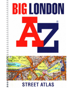
Navigate your way around London with this detailed, easy-to-use and up-to-date A-Z Street Atlas. First published in 1936, this iconic atlas is a trusted means of finding your way around the capital city. The main mapping extends beyond Central London from Heathrow Airport to Chingford at a scale of 2.88 inches to 1 mile, featuring postcode districts, one-way streets, the Congestion Charging Zone and Low Emission Zone. The large-scale street map of Central London – at a scale of 5.75 inches to 1 mile – cover Regent’s Park and Shoreditch, Chelsea and Vauxhall, Hyde Park and Bermondsey. A comprehensive index lists streets, selected flats, walkways and places of interest, place, area and junction names. Additional healthcare (hospitals, walk-in centres and hospices) and transport connections (National Rail, London Tramlink, Docklands Light Railway, London Underground and Overground stations, and River Bus pier) are indexed as well. Also included are: • Overview map of the Congestion Charging Zone • West End Theatre map • London Connections rail services map • London Underground map
Издательство: Harpercollins
ISBN: 9780008387990
Штрих-код: 9780008387990
Цвет: Белый
Объем: 462
Ширина: 130 мм
Длина: 193 мм
Высота: 20 мм
Год: 2020
Вес: 536 г
Группа: Книги
Обложка: мягкая обложка
vat: VAT_20
подробнее...
ISBN: 9780008387990
Штрих-код: 9780008387990
Цвет: Белый
Объем: 462
Ширина: 130 мм
Длина: 193 мм
Высота: 20 мм
Год: 2020
Вес: 536 г
Группа: Книги
Обложка: мягкая обложка
vat: VAT_20
подробнее...
Комментарии, отзывы о "London A-Z Street Atlas":
Добавить первый отзыв ...
Посетители интересовались: